The snowstorm heading for Colorado’s foothills, Front Range and Eastern Plains will still likely pack a powerful punch, but the timing of its arrival has been pushed back a bit.
A Winter Storm Warning posted by the National Weather Service for the storm has been pushed back, the warning now starts at 5 a.m. Saturday and will run through 6 a.m. Monday. Earlier, the warning was posted to start at midnight Friday and run through midnight Sunday.
“That’s the nature of numerical weather models, a couple of models are thinking it is going to move slower,” said Robert Koopmeiners, a meteorologist with the weather service in Boulder.
The possible delay in timing doesn’t necessarily mean that the system will be weaker, or that it will taper off and not bring as much snow as predicted — one to two feet in the urban corridor with two to four feet in the foothills, especially the northern foothills, by Monday morning. Denver is expected to get about 20 inches of snow by the storm’s end.
“March is Denver’s snowiest month, if you are going to get it, you are going to get it now,” Koopmeiners said.
The “significant winter storm” is forecast to peak in intensity overnight Saturday into Sunday, Koopmeiners said.
Temperatures, in the upper 20s, along with upslope and high moisture content are expected to combine overnight Saturday and give the storm some wallop.
“The fiercest period will be Saturday night into the start of Sunday,” Koopmeiners said.
On Saturday, in Denver, new snow accumulation is expected to be 3 to 5 inches, with additional accumulation of 4 to 8 inches on Saturday night. The chance for precipitation is 100%, according to the weather service. The daytime high temperature will be 34 degrees and the overnight low will be about 30 degrees.
Snow is expected to remain heavy at times in Denver on Sunday, when there’s a 90% chance for precipitation and winds will pick up, gusting to 29 mph, the weather service said. Snow on Sunday night in the city is likely before 11 p.m., the chance of precipitation is 70% and the low temperature will drop to 24 degrees.
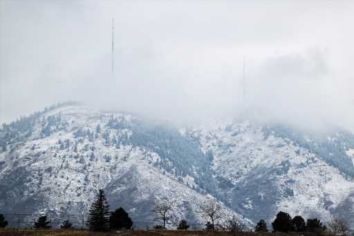
Other Colorado cities in the Winter Storm Warning area include Fort Collins, Greeley, Limon, Granby, Georgetown, Aspen, Castle Rock, Colorado Springs and Cañon City. Larimer County is expected to be among the hardest-hit areas.
Statewide, snowfall will be lighter west of the Continental Divide. On the Eastern Plains warmer temperatures are expected to result in rain mixing with snow, which could reduce snow depths in some areas, especially along the Kansas and Nebraska borders.
Travel across the metro area and along the foothills “may become nearly impossible late Saturday through much of Sunday during the height of this storm,” the weather service warns.
Authorities and officials in Denver and beyond have asked residents to take heed of the forecast and stay home, only venturing out if it is absolutely necessary or an emergency. Denver International Airport is expecting flight delays and cancellations over the weekend and metro area events, including COVID-19 testing and vaccine distributions, have been canceled.
The Colorado State Patrol and the Colorado Department of Transportation are among the entities asking that motorists stay off the roads for safety considerations and so snowplow drivers can plow with less obstruction.
The powerful system is expected to wind down on Monday, with road conditions improving although there may still be deep snow depths on secondary roads, especially in the foothills. On Monday there’s a 20% chance for snow in Denver before 11 a.m. and the high temperature should climb to 41 degrees under partly cloudy skies.
The forecast calls for another system to bring a chance for snow to the Denver area late Tuesday into Wednesday, but that system will be weaker and of shorter duration.
Source: Read Full Article


