BBC Weather: Britain braces for snowfall on saturday
We use your sign-up to provide content in ways you’ve consented to and to improve our understanding of you. This may include adverts from us and 3rd parties based on our understanding. You can unsubscribe at any time. More info
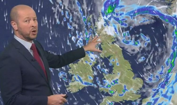
BBC Weather’s Darren Bett warned Storm Arwen is set to move in across the UK bringing with it 75mph winds which could cause travel disruption and damage to buildings. The Met Office has issued an amber wind warning for parts of northeast England and Scotland from Friday afternoon, lasting until Saturday morning as the result of the storm. Mr Bett said: “It’s been a cold but sunny day for most of us today however the first named storm of the season is on its way arriving in northern parts of the UK on Friday.
“Sweeping gales across many areas into Saturday. There will be some snow mainly over the hills and some disruption to travel is expected.
“Temperatures will be tumbling very quickly but there is more cloud and some rain arriving into Scotland and that cloudly, wetter weather will sweep southwards overnight.
“The cloud and patchy rain continue to drive southwards across the UK tomorrow morning and then we’ll get some brighter skies with some sunshine following.
“Shower may turn wintry and we’re going to find some snow beginning to arrive in northern parts of Scotland as things really start to pick up.”


He added: “Gusts of 75mph or more near those coastal areas.
“Storm Arwen is going to track out into the North Sea. It’s got some rain and snow wrapped around it but it’s on the back edge of that storm we’ve got those really strong winds.
“When you add on the strength of the wind it is going to feel significantly colder on Saturday.”
The Met Office said that flying debris leading to injuries or danger to life is “likely” with people also told to expect damage to trees and buildings, public transport cancellations, road and bridge closures, power cuts and large waves.
Met Office: Severe gales and 'disruptive weather' forecast
Yellow wind warnings are also in place across most western parts of the UK on Friday, extending to the rest of the country on Saturday.
Gusts are expected to reach 55 to 65 mph in parts of Scotland, Northern Ireland, Wales, south-west England and north-east England with the highest to be seen in coastal areas.
Stephen Dixon, a Met Office spokesman, told the PA news agency: “Storm Arwen has been named on the back of a deep low-pressure system moving to the north-east of the UK, which has brought about our amber wind warning on Friday.
“The worst affected areas will predominantly be on the coasts, with gusts of over 75mph bringing possible disruption to travel and longer journey times, power cuts, flying debris and large waves with beach material being thrown around.
DON’T MISS
UK weather map: Exact time and locations Storm Arwen will hit tomorrow [MAP]
Solar storm warning: Sun ejects 50,000 mile-long ‘canyon of plasma’ [INSIGHT]
BBC Weather: Snow showers to move into UK as northerly winds [VIDEO]

“There is also a yellow warning of wind in place along the west coast of the UK from 9am on Friday, stretching from Scotland, through Northern Ireland and Wales and as far as south-west England.
“This reflects the impact Storm Arwen will have, with strong winds likely to occur into Saturday, when the warning is extended to most parts of the UK.
“The south-east and London, though fairly windy, are likely to escape the worst of the gusts and remain relatively calm in comparison to the rest of the country, which will certainly feel the impact of the storm.”
He said Storm Arwen is moving in from the North Sea and will begin to travel south before easing on Sunday.
Source: Read Full Article


