BRITAIN is about to be hit by freezing temperatures and high winds as a "polar vortex" brings a 10-day Arctic blast.
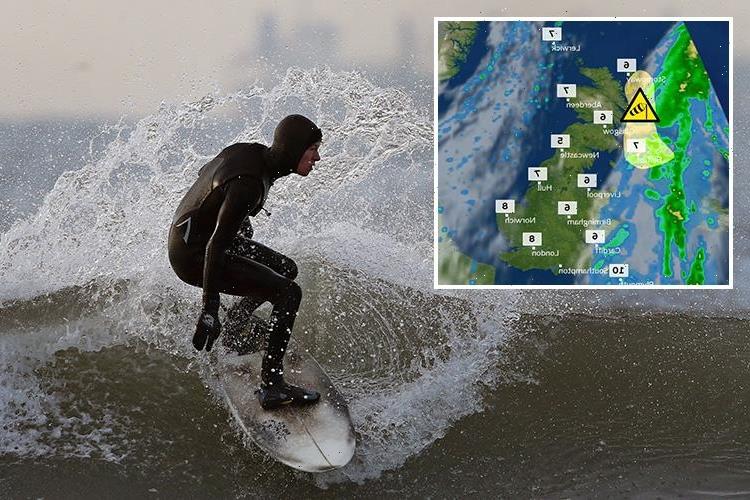
The Met Office warned last night that that up to four inches of snow could fall over high ground in some parts of the country tomorrow.


Forecasters have warned to brace for a "big change" as icy winds sweep in from Russia and the Arctic region.
Thermometers in parts will nosedive to -10C (14F) overnight by the end of the week bringing harsh frosts and icy roads.
Wind changes high in the atmosphere are being blamed for the colder weather triggered a Sudden Stratospheric Warming (SSW) event at the end of January.
The phenomenon affects air circulating the North Pole causing it to swoop southwards or ‘displace’ over Europe and the UK.


Piers Corbyn, forecaster for WeatherAction, said temperatures will plummet through the week with cold weather likely to hold out for a fortnight.
He said: “There are several things going on at the moment which are going to bring very cold and wintry conditions to Britain over the next few days.
“We have had a Sudden Stratospheric Warming and this has caused Arctic air to sink southwards – a so-called displaced Polar vortex.


“High pressure to the northeast of the country will pull very cold conditions in from Russia while low pressure to the west will drag slightly milder, but still cold, air in from the Atlantic.
“The overall effect is that we are getting a cold blast from both sides; where these meet, moisture will turn to snow.
“We could see some heavy show showers at this boundary over the next week or so, and despite the odd mild spell it is looking cold for the next fortnight.”
RELATED STORIES
LEAF IT OUT! 
British supermarkets begin RATIONING vegetables after bad weather in Spain decimates supplies of lettuce, broccoli and courgettes

Heart-stopping moment Boeing 777 carrying 300 passengers forced to make emergency landing on snow-covered runway

Brave snowboarder labelled a 'hero' for wrestling out-of-control snowmobile on busy ski run

Dramatic Nasa satellite image shows Storm Doris hurtling across the Atlantic as it prepares to hit UK TOMORROW bringing 80mph gales
He said thermometers in the north will hit -10C (14F) overnight during the next few days with lows of around -5C (23F) elsewhere.
Daytime highs will struggle to get much above freezing in Scotland and the north while the south will hover between 1C (33.8F) and 4C (39.2).
Meteorologists say the weather will change, with colder temperatures spreading from the east on Wednesday, accompanied by the chance of wintry showers.


The Met Office has also issued warnings of high winds in Northern Ireland and parts of western Scotland at the beginning of this week.
Emma Sharples, from the Met Office, said temperatures are likely to dip by at least two or three degrees by Thursday for much of England with day time maximums unlikely to rise higher than around 5C (41F).


Ms Sharples said: "We'll definitely be seeing low single figures by the end of the week.
"And, of course, overnight, where skies remain clear and away from coastal areas, we'll see temperatures dipping down to negative figures
"The wind will start to pick up from the east, so it's not just numerically temperatures being low but, also, the wind chill's going to add to that as well."
She said the colder temperatures could be accompanied by the odd wintry flurry, mostly in the east.
Source: Read Full Article


