BBC Weather: Thundery rain forecast across UK
We use your sign-up to provide content in ways you’ve consented to and to improve our understanding of you. This may include adverts from us and 3rd parties based on our understanding. You can unsubscribe at any time. More info
Whilst the Met Office enforced a number of yellow thunderstorms across parts of England, Wales and Northern Ireland until later today, the weather is predicted to take an upward turn as the week goes on. Temperatures are due to rise to the highest levels we’ve seen this week, with some areas expected to see a 26C scorcher.
The hot African air plume that swept from the south enabled many parts of the UK to bask in warm and sunny conditions over the course of the weekend, with some areas reaching temperatures as high as 24C on Saturday.
The weather has been particularly volatile since, as areas across the midlands, north of England, northern areas of Wales, and Northern Ireland have been issued with yellow thunderstorm warnings until 10pm today.
However, the Met Office predicted a “fine end to the day” today, with temperatures and conditions only predicted to improve as the week draws on.
Met Office meteorologist Aidan McGivern predicted temperatures at the start of this week will see low to mid 20Cs “fairly widely”, but we’ll soon see “high 20s around the South-East” if we get the sunshine associated with this plume.

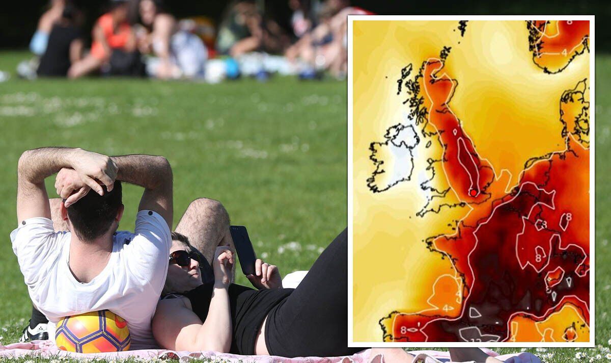
What areas will see the sunshine?
Netweather predicted temperature records will be broken for the year once again on Tuesday, May 17, as the mercury is due to climb to a staggering 26C.
Temperatures will vary across the UK, but London and more central areas are predicted to see these temperature highs, while the humidity and wind conditions could make the air feel more like 28C, according to Netweather.
Areas around Peterborough and Lincoln are due to see highs of 24C, whereas temperatures are predicted to gradually lower in the north and more western regions of the UK; but only by a fraction.

Birmingham, Manchester, York, and spreading across to Norwich are due to see highs of 22C, but areas spanning the southwest of England and Wales will see slightly lower temperatures, varying from 12C to 20C.
Pembrook and Camborne, to Londonderry and Belfast, are predicted to see the lowest temperatures with around 12C to 13C degrees, whereas parts of Scotland are predicted to see more moderate temperatures of around 17C to 18C on average.
The Met Office forecast for Tuesday reads conditions will be “Dry and very warm in sunny spells across many central and eastern parts.”
DON’T MISS:
How to create a ‘rainbow’ on your dinner plate for BBQ season [EXPLAINED]
Wish you weren’t here! – the UK beach resort branded ‘no go zone’ [INSIGHT]
Amazing’ Tripadvisor beach is one of the ‘best known’ in Turkey [ANALYSIS]

However, as the day draws on, conditions are due to become “cloudier in the west with rain turning heavy, edging into central parts into the evening.”
Wednesday’s temperatures are due to drop a few degrees across the board.
The Met Office forecasted conditions will be “dry and sunny for much of Wednesday before heavy rain spreads from the west and south later”.
It said: “This clears early Thursday leaving behind sunny spells, before further rain in places Friday.”
Source: Read Full Article


