BBC Weather: Europe set for ‘significant thunderstorms’
We use your sign-up to provide content in ways you’ve consented to and to improve our understanding of you. This may include adverts from us and 3rd parties based on our understanding. You can unsubscribe at any time. More info
Mountain hikers in Scotland are battling against harsher winds and blizzards, while much of the UK has seen a drastic drop from the unseasonably balmy September. It comes as meteorologists suggest a cold front will strike the UK as October begins, bringing a more conventional autumn.
Alongside pictures taken from Ben Nevis, hikers described snow on the summit of the mountain, “although very soft and superficial”.
Social media users have said “it’s too early for snow just now”, with others noting it is “unusually cold” on the mountains.
Christian Howell, who climbed Lochnagar, said on his Mountain Guide page Walk Glencoe: “It is pretty early for snow, it’s unusually cold.
“I wasn’t expecting to see snow for another couple of weeks.
“It took me by surprise, you’d expect it on Ben Nevis but not where I was at 900m.
“It was a cold and wet day, when the snow stopped the rain came back on.”


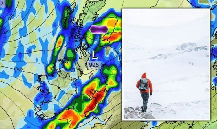
Maps from WXCharts indicate that Friday will see snow start in earnest in Scotland.
From 6am, around one centimetre of snow per hour will fall just south of Inverness.
The snowfall is expected to stop before midday on Friday, before starting again at around 3am on Saturday.
However, much of the UK will see wet conditions last throughout the week, with Wednesday the only day without rainfall up to 10mm an hour.


Simon Partridge, meteorologist at the Met Office, said Wednesday will be the “best day of the week”, with lots of sunshine predicted and highs of 15C.
“The word ‘unsettled’ definitely covers it this week,” he said.
“It’s going to be very autumnal.
“At this time of year, our average maximum temperature for south-east England is only about 17 or 18C, so it’s really about where we should be.
“We’ve got used to temperatures being higher than they usually are – we’ve just come back to reality.”

Mary Gilbert, meteorologist at AccuWeather, told Express.co.uk: “Even before the weekend’s cold front, this week is forecast to become very active across the UK.
“A potent storm is forecast to push Ireland and the UK late this week and usher in periods of strong to near-gale-force winds.
“Winds of this level can be locally damaging in nature and there is the potential for tree damage and power outages. Periods of heavy rain can also accompany these gusty winds.
“Any areas caught under a deluge may encounter localised flooding issues, especially in low-lying or poor drainage areas.”

In its weekly forecast, BBC Weather said a “sharp cold front is expected to push across the country Sunday night”.
They state: “This front will bring a much cooler Atlantic air into the UK with temperatures moderating to near or below normal and staying there for much of next week.
“Low pressure systems will also frequent Northwest Europe, keeping things unsettled, often wet and windy, and changeable day-to-day.
“Rain heavy at times, with strong winds on the coast making for some stormy days.”
Source: Read Full Article


