BBC Weather: Louise Lear addresses extreme heat warning
We use your sign-up to provide content in ways you’ve consented to and to improve our understanding of you. This may include adverts from us and 3rd parties based on our understanding. You can unsubscribe at any time. More info
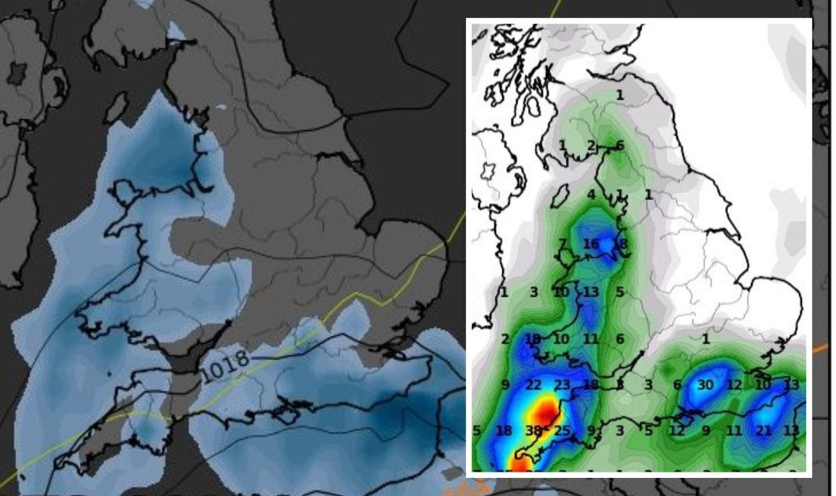
The Met Office has issued its first-ever red alert for the potentially record-breaking hot weather for this Monday and Tuesday. But the weather could rapidly return to cool and rainy as the rest of the week will bring temperatures of even below 10C degrees, and scattered showers across the country. The switch to cooler weather is forecasted to take place overnight from Tuesday to Wednesday and it could be accompanied by thundery rain in places, according to the Met Office.
The forecast for Tuesday to Thursday reads: “Extremely hot for many on Tuesday before a change to cooler weather through Tuesday night and Wednesday, accompanied by thundery rain in places. Fine with a few showers on Thursday.”
Maps show lows of up to 7C degrees in Wales on Thursday, 9C degrees in Leeds, and 12C degrees in London on that day.
The coolest temperatures could be felt on Friday, as maps show as low as 5C degrees near Inverness, Scotland on that day.
But cooler temperatures will also be seen in the South on Friday, with lows of 8-9C degrees in Birmingham, 10C degrees in London, 11C degrees in Bristol and 12C degrees in Leeds.
The Netweather forecast reads: “Along with the cooler temperatures on Tuesday night, there’s also likely to be some thundery downpours around – some potentially affecting eastern and southeastern England but most of the rain will run through western England, Wales and up into southern, central and perhaps northern Scotland.
“Some of those downpours and storms will transfer east during Wednesday with some lively storms and torrential showers possible.”
British Weather Services senior meteorologist, Jim Dale, told Express.co.uk: “Given the fact that we’re going to see temperatures knocking on the door of the UK record, there’s every chance that the breakdown might produce severe weather.
“Monday and Tuesday look very humid and that’s when thunderstorms will start breaking out sporadically across France – some of those will arguably move into Britain.
DON’T MISS: UK heatwave: Panic as raft of summer events cancelled amid 40C alerts
Dog owners issued urgent warning over pets’ paws as they swelter in UK heatwave
Chaos as train tracks burst into FLAMES after ‘extreme’ hot weather
“England and southern Wales will be affected, with the south coast being the first main hit.”
The thunderclouds, or else called ‘cumulonimbus’ clouds that bring storms and lightning to the UK, are menacing-looking multi-level clouds, extending high into the sky in towers or plumes.
They are the only clouds which can produce hail, thunder and lightning.
Explaining the phenomenon, Mr Dale, told Express.co.uk: “Thunderstorms have the capability to give deluges, torrential rain, hail, and mini tornadoes.”
Scattered showers will continue to strike the country over the weekend.
Source: Read Full Article


